- Тип техники
- Бренд
Просмотр инструкции gps-навигатора NAVITEL T500 3G, страница 40

NAVITEL T500 3G | 39
EN
Routing
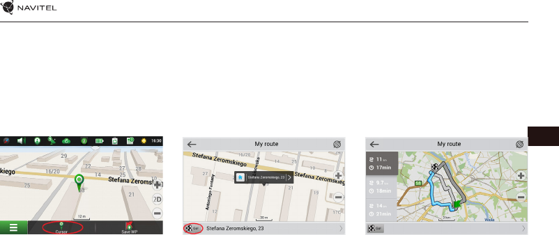
Route to a point selected on the map
You can have a route planned to a point, which can be found and marked on the map and then set as the destination,
while current position of the device, determined by the GPS system becomes the starting point. To plan a route press
on the map to mark the point, select “Cursor” [1] and then “Go!” [2]. The program will offer 3 alternate routes with an
approximate distance and time to the finish point [3]. Press «Go!» to start follow the route.
Fig. 1 Fig. 2
Fig. 3
Route to an address
To have a route calculated to a point of a known address, press “Menu” in the bottom left corner of the screen [4] >
“Find” [5] > “By address” [6], then press “Select country” and start entering the name of a country [7]. Press the icon in
the upper right part of the screen to hide the keyboard. Select the country [8]. “Select city”, “Select street” and «Select
a building» become active only if the previous fields were filled out [9]. When all information is entered the object will
be shown in the screen [10]. Press «Go!». The program will offer 3 route options from a current location to the indicated
address [11]. Now you can follow the route [12].
Ваш отзыв будет первым
Вопросы пользователей
Поиск:
по производителю
по типу техники
по модели
Сортировать:
по дате


c ответами


Гость
07 декабря 2020, Екатеринбург
Как он работает


 0
0